| Site de promotion de la mappemonde océanique |
THE OCEANS OF THE WORLD MAP
How to represent the world ocean map ?
Our planet is covered at 70% by
water. Yet, the flat representations of our spherical planet trend to
favor the view of the continents (except Antarctic),
distorting or
cutting the ocean. So, circumnavigation (around the world)
representation can be stopped on the left side of a map and be started
again on the right side.Over all, unlike the continents which really
are different entities, all
these maps blok off there are not three either five continents, but
there is a single global ocean.
The goal is to build AN OCEANIC PLANISPHERE showing the 'oceans of the world' as a continuous and united one.
Caracteristics :
The method consists in
keeping the continuity of the world ocean to the detriment of the
continents, mainly the American continent cut and relegated to the
peripheral. It’s an elliptical marine planisphere, for
instance with
an
'equivalent' representation (which preserves the surfaces).
The poles
of the map are not any more at 90° north and south latitude,
but are at about 52°south 70°west (closed to the Horn
cape) and on the opposite at 52°north 110°est (closed
to the Baikal lake). The limits are on one side the Bering Strait (to
keep the whole surface of the Arctic), and on the other side the Andes
mountains (to keep the whole surface of the Pacific). In this case, the
« pound » center is located at about
40°south 85°west (closed to the Amsterdam and Saint
Paul islands).
Some possible applications of this Atlas of the World Ocean:
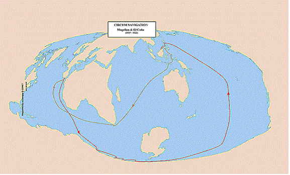 |
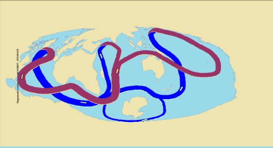
Transport in the ocean :
- sailing races, - merchant fleet management, - the great discoveries, - ... |
 |
Dynamic of the ocean :
- oceanic conveyor belt, - variations of ocean temperatures, - marine weather forecast, - ... |
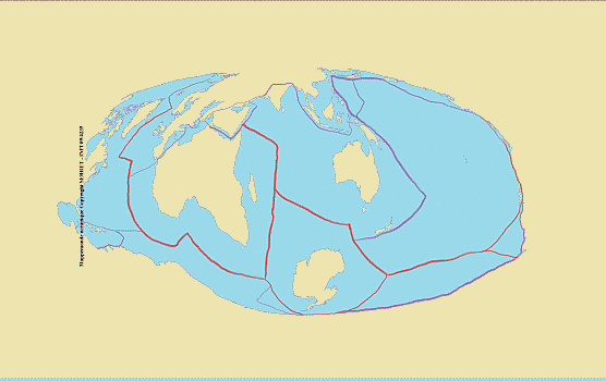 |
Study of seabed :
- tectonic plates, sea-floor spreading, - tsunami spreading, - ... |
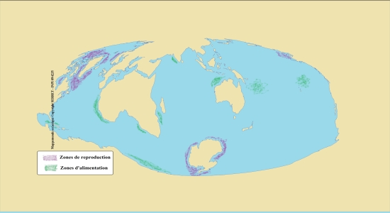 |
Locating maritime
wildlife and flora : - whales, - plankton, - pollution, - ... |